Top sights in Madaba
Facts About Madaba
The governorate of Madaba is located south of the capital, Amman, approximately 35 kilometers (774 meters) from sea level and dates back to the Iron Age (1200-1160 BC). Lewayin governorate (Kasbah Madaba Brigade, Dayban Brigade), five districts (Greena District, Ma 'in District, Al Faisaliyah District, Broad District, Maleh District) and 4 municipalities.
The governorate is characterized by a variety of forms of tourism, both in the area of religious, therapeutic and recreational tourism, cultural and historical tourism. The governorate of Ma 'adba is characterized by its diverse terrain. It is renowned for its wide simplified ease, which serves to supply the Kingdom with abundant quantities of cereals, as well as its Ghorawi and Shafagorian regions, which are one of the most important sources of production of vegetables, fruits and olives.
The city is decorated with beautiful mosaics, previously chronicled, experiences that have been and continue to be part of our present history, and in this place the ancient mosques and churches are hugging to embody a model of fraternity and peace. A banquet name has changed over different historical stages, only slightly in word, giving a clear and important indication of the history of the city.
The name of a banquet town is based on several possibilities. There is a possibility that the word is surreal, meaning "place of mud" or "quiet water", because water usually settles around the city, and another possibility is that the name is Aramaic, where a banquet consists of two words; They are "Mia" and "IP", first means water, second means fruit.
According to last year's official statistics, the Ministry of Tourism and Antiquities of Jordan announced that the city had won the title of Arab tourism capital in 2022, after achieving all the benchmarks and conditions prepared by the Arab Tourism Organization.
A city banquet steeped in foot, characterized by the passage of different civilizations, The city was part of the favourable State, which was founded in the 13th century BC, It was one of the stations of the Kings Road, which was the most important commercial route, Which links Egypt to the country of Al-Sham, the city has moved between civilizations and settled with them since the dawn of history, It was under the control of the Amori and Ammonites and occupied by the Ashori, and then, as we know, the region was later invaded by Persian.
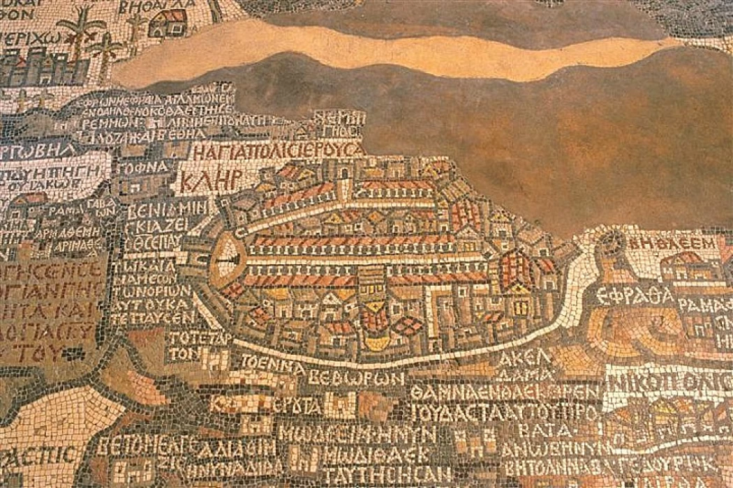
At the beginning of the second century, the city was dominated by the Romans, and the city was distinguished in this era by the construction of baptized streets, buildings and distinctive water basins. In the Byzantine period, the city developed especially after the spread of Christianity, and witnessed the construction of churches in a striking manner, the most important of which was the Church of the Map.
Unfortunately, the region has been hit by powerful earthquakes that have hit banquets and other cities in Jordan and Palestine. However, the city has a huge history that cannot be passed without stopping and identifying itself for very important periods. A banquet is also famous for mosaic, where it is known as the city of mosaic and has a map of a banquet which is part of the mosaic floor of an ancient church, the oldest original map of the Holy Land s Church at a banquet, built in 1896 above the remains of the Byzantine Church.


