Archaeological sites in Jerash
Facts About Jerash
It is a Jordanian city that is the largest city in Jerash Governorate, which is about 48 km north of the Jordanian capital, Amman, and is about 600 meters above sea level. With a population of about 41500 thousand people, its founding dates back to the reign of Alexander the Great in the fourth century BC. It was then called “Grassa” in Greek, and the Semitic Arabs later called it Grasha or Gershaw, which means: “a densely wooded place”.
Jarasa came under the rule of the Romans, who conquered the Levant and established a federation of ten cities, known as the Decapolis, ten Roman cities established by Pompey in 63 BC, to form an economic and cultural federation in northern Palestine, Jordan, and southern Syria to confront the Nabataeans.
The city turned into a thriving commercial and cultural center, due to its location at the crossroads of caravan routes, and later became the most important city of the Federation during the reign of Emperor Hadrian, and the Romans introduced the Christian religion to it in 350 AD to flourish in the construction and construction of Christian churches and monasteries.
In 635 AD, the armies of the Islamic conquest led by Sharhabil ibn Hasanah entered it during the reign of the second caliph, and the city regained its prosperity in the Umayyad era, and in 747 AD, earthquakes destroyed large parts of the city.
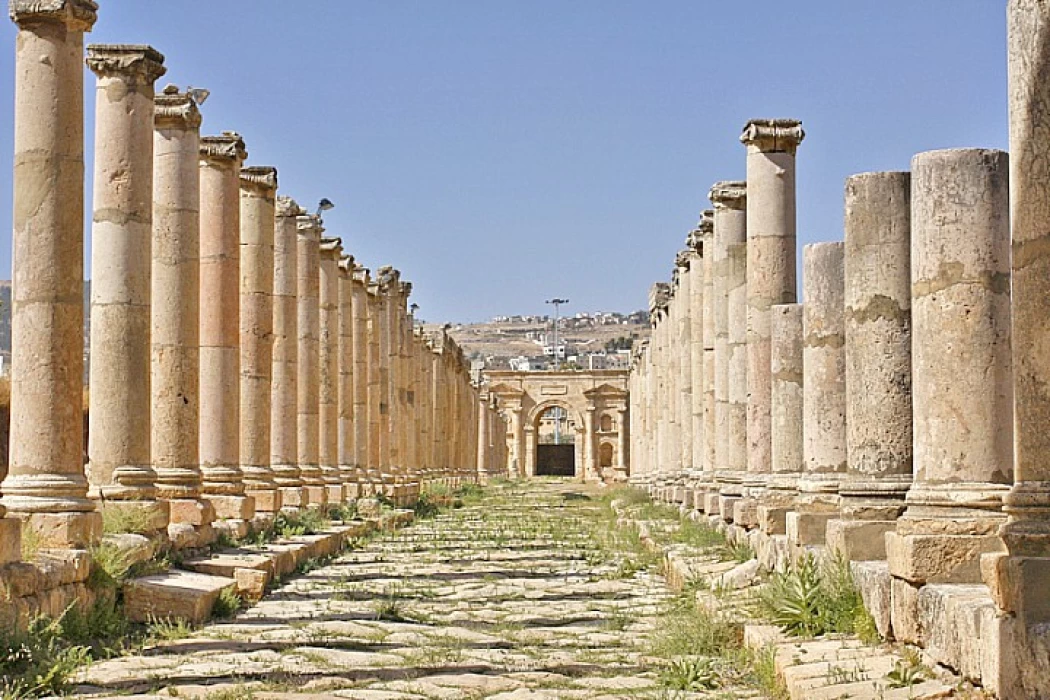
The most important tourist and archaeological attractions in Jerash The city of Jerash ranks second in the list of the most important tourist areas in Jordan, and among the most important archaeological areas are the following: Columns Street is the main street in the area, about a kilometer long, tiled on both sides, and surrounded by 71 marble columns, out of 520 columns that existed previously.
The Nymphaeum is a building built in the second century AD, which includes a group of fountains dedicated to nymphs, the most famous of which is the Nymphaeum built in 191 AD, which consists of two floors of marble basins and fountains of picturesque water that enchant tourists and visitors. The Temple of Artemis, built in the second century AD, was dedicated to the gods responsible for guarding the city, It also features numerous temples dedicated to Zephas and Zeus, as well as a graveyard, baths, and drainage ditches.
The Hippodrome, also known as the circus, is characterized by its shape similar to a horseshoe, where horse races were held, a custom taken from the Greeks. The pools of Jerash are considered one of the most important sources of water in the city, currently known as Ain al-Qayrawan, and it is indicated that the Romans used to hold ceremonies at these pools to welcome the spring season. The Hamidi Mosque is one of the most famous mosques in Jerash, named after Sultan Abdul Hamid, and was built at the end of the ninth century.


