Sinai Peninsula
The Sinai Peninsula, also referred to as Turquoise Land, is a triangular desert region that draws a diverse array of tourists during their travels in Egypt. This area is situated in the northeastern section of the Arab Republic of Egypt and is the only part of the country that is geographically connected to Asia. Covering approximately 60,000 square kilometers (23,000 square miles) and home to around 1,400,000 residents, it constitutes 6% of Egypt's total land area. The peninsula is bordered to the north by the Mediterranean Sea and to the west by the Gulf of Suez. From an administrative perspective, Turquoise Land is divided into two governorates: South Sinai and North Sinai, with three additional governorates located along the Suez Canal.
A prominent ridge extends along the southern perimeter of the Sinai Peninsula, forming a significant horseshoe shape. It is estimated that the Sinai desert receives over 1.6 million acres (approximately 2 billion cubic meters) of water each year from local precipitation. Roughly one-quarter of this water flows across the surface as a substantial stream, while a similar volume infiltrates underground reservoirs, creating excellent opportunities for water conservation. The region borders African Egypt, with the Port Said Governorate to the north, Ismailia Governorate in the center, and Suez Governorate at the southern terminus of the Suez Canal.
The Sinai Peninsula has been inhabited since prehistoric times, with the earliest documented references dating back to 3000 B.C. during the early dynastic periods of the 1st and 2nd dynasties of Egyptian history. The name "Sinai" appears to have been recognized early on, potentially originating from the name of one of the oldest religious sects in the Middle East, associated with the moon. Its strategic location, which overlooks present-day territories such as Syria, Lebanon, Jordan, Israel, and Palestine, has facilitated cultural exchanges and has also been a source of numerous disputes between Egypt and neighboring countries. Historically, the northern coast of Sinai has served as a vital trade route connecting Egypt and Palestine for centuries.
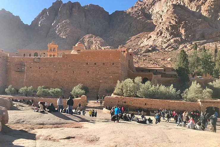
During the early Christian era, Mount Sinai in Egypt became a refuge for numerous hermits and ascetics, particularly in the mountainous southern areas. In 530 A.D., Byzantine Emperor Justinian I initiated the construction of the Monastery of Saint Catherine on the slopes of Mount Sinai. This establishment became a focal point for Christian communities in the region and served as a significant pilgrimage destination during the Middle Ages. However, conditions in Sinai worsened, making travel increasingly challenging after Egypt achieved independence from direct Turkish control in the early nineteenth century. Al-Arish also witnessed conflict between Turkish and British forces during World War I, and following the war, Sinai was transferred to Egyptian governance.
In 1956, Israel launched an attack and occupied Sinai, an event referred to in Egypt as the Triple Aggression due to the simultaneous involvement of the United Kingdom, France, and Israel. Nevertheless, on October 6, 1973, Egyptian forces successfully defeated Israel, leading to intense hostilities in the northeastern part of the peninsula during the conflicts of 1956, 1967, and 1973. Following the peace agreement between Egypt and Israel in the late 1970s, the Sinai Peninsula was returned to Egypt. The 1979 peace treaty resulted in Israel's withdrawal from the Sinai Peninsula, with the exception of the contentious Taba region, which was reinstated to Egypt following a judicial ruling in 1989.
Sinai has emerged as a prominent tourist destination due to its stunning natural landscapes, vibrant coral reefs, and significant historical heritage. Mount Sinai stands out as one of Egypt's most revered religious landmarks. As of January 2013, the region boasts a population of 597,000. The Suez Canal is flanked by three additional governorates that extend into African Egypt: Suez (el-Sewais) at the southern terminus, Ismailia (el-Isma'ileyyah) centrally located, and Port Said to the north.
Arish, the largest city in Sinai and the capital of North Sinai, is home to approximately 160,000 inhabitants. Other notable urban centers include Sharm el-Sheikh and El-Tor, situated along the southern coastline. The interior of Sinai is characterized by arid, desert-like conditions, mountainous terrain, and a sparse population, with the principal settlements being Saint Catherine and Nikhil.


