Baptism Site (Al-Maghtas)
Al-Maghtas
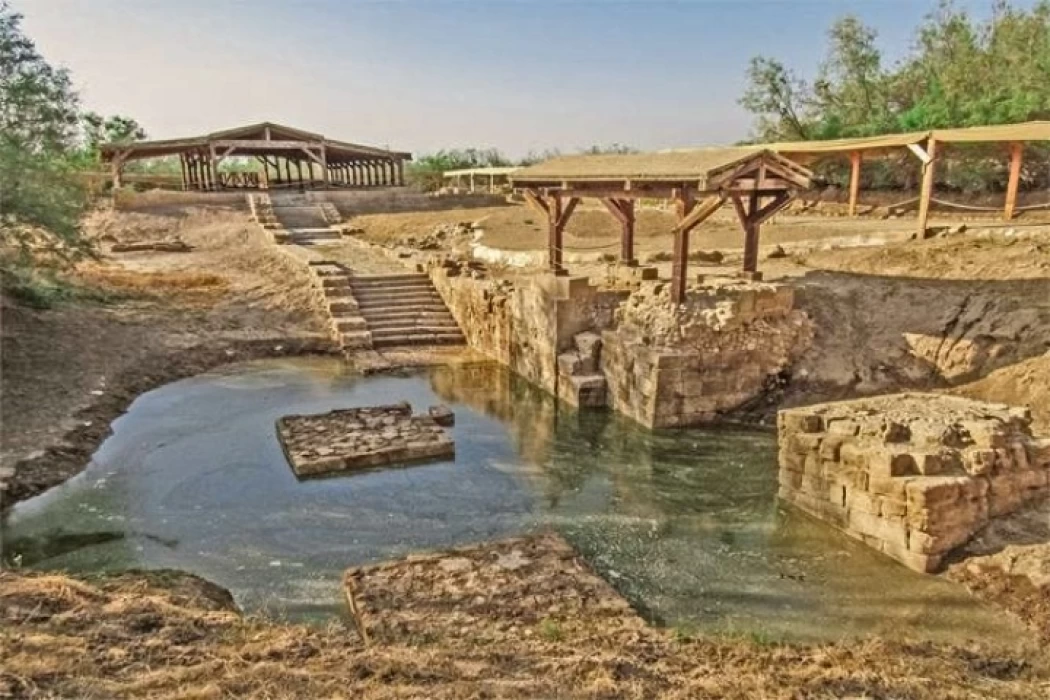
Approved by the United Nations Educational Scientific and Cultural Organization (UNESCO) World Heritage Center in 2015, The Baptism Site is one of the several geographical locations that encompasses a figurative religion which attracts people from both within and outside the country in addition to its moral and historical appreciation to all Christian denominations as one of the top Christian pilgrimage sites across the globe. Situated to the east of the banks of the Jordan, The Baptism Site is approximately 9 kilometers to the north of the Dead Sea.
The historical importance of this unique site lies in the fact that it was the cradle of many prophets, messengers, and saints, such as Yahya ibn Zakariya (peace be upon him), and Elijah (peace be upon him), and it is the place where Jesus (peace be upon him) began to spread his message when he came to Yahya (peace be upon him) specifically in this area, in addition to being a site that witnessed the brotherhood between religions throughout the era of Omar, during which church construction continued from the beginning of the Byzantine era until the beginning of the Islamic era.
The most important landmarks in this area:
The prayer hall: This hall is one of the oldest places of worship in the Al-Maghtas area, dating back to the fourth century AD. It is a hall built in a rectangular shape using the stones of the area, covered with a layer of white mosaic stones. It is said that this square had a wooden roof, and its construction and design date back to the beginning of the Byzantine era.
Cave Church: This church is divided into two sections. The first section contains an altar carved in a semicircle in the natural rocks, while the second section is in the form of a large central nave and contains 4 visible columns. The history of this church in particular dates back to the Byzantine era.
The Northern Church: This church is distinguished by having two entrances, the first in its northern wall, and the second in its western wall, in addition to its floor studded with colored mosaic stones arranged in geometric shapes. These engravings date back to special Greek designs.
Rotorius Monastery: This monastery dates back to the 5th and 6th centuries AD. It contains the remains of several buildings and churches surrounded by a wall around its entire perimeter. The northwestern wall contains an entrance that led to the place where the monks lived. This monastery has an innovative system for distributing water.
Ponds: There are 3 ponds on Al-Kharrar Hill, which are: a large rectangular pond, while the other two ponds are small. All of these ponds date back to the Roman era, and were supplied with water through raised channels in the form of arches.
Water regulation area: This area consists of a water well, a reservoir, and basins into which water channels are poured to purify the water. The construction of this reservoir dates back to the fifth and sixth centuries AD.
Pilgrims' Station: Christians began flocking to this station since the fourth century AD, as a necessary station during their pilgrimage journey, as they arrive at the pilgrims' station after passing through Mount Nebo in Madaba Governorate, passing through the city of Jericho. This station, which was built in the Byzantine period, included rooms in a large, open square, the remains of which still exist to this day.
Baptism: For Christians, this landmark is a symbol of a person's purity and belonging to Christianity, and that once he is baptized, he becomes affiliated with the Christian places of worship. Children are baptized in this landmark as a duty upon them, and then they have another baptism when they reach adulthood when they understand right from wrong.


